Citizen science at our field site

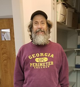
We’re grateful for the assistance that Dr. Andy Penniman has been providing to our field crew over the past few years. Andy has been helping with field experiments and with processing invertebrate samples in the field. He’s also provided us with a number of photographs of our field crew in action.
We have a few opportunities for additional volunteers to help our program. Tasks can be customized to your skills and interests, but we’re looking for a limited number of mature, responsible people who can really make a contribution, either with field work, laboratory work, or outreach.To discuss possibilities, contact Dr. Steven Pennings, GCE Field Coordinator, at scpennin@central.uh.edu.
Citizen science online
We need help from citizen scientists to better understand the ecology of coastal salt marshes. We have over 70,000 overlapping photographs of a salt marsh, taken every year from 2010 to 2016, and need to align them to create detailed maps for each year. Because the images are taken from close to the marsh surface, and lack strong visual features, software programs don’t do a good job of aligning them automatically. The “Scaling Up Marsh Science” web site allows citizen scientists like you to help us by identifying matching features in pairs of photographs. This information will then be used to create a photographic map of a large area, understand how species are distributed and associate with each other within that area, and learn how their distribution patterns change from year to year. At the same time, citizen scientists will learn some basic facts about salt marsh ecology.
Click to access the Scaling Up web site!
For more information, contact Steven Pennings, University of Houston, scpennin@central.uh.edu.
The details: Why and how we took these photographs
We’re interested in better understanding the spatial relationships among the different salt marsh species. For example, snails may associate closely with one plant species and avoid another. To examine these relationships, we need a map that shows the locations of all the species.
Think of google earth—it has transformed how scientists in many disciplines work, because it allows them to see spatial relationships over a large landscape. But google earth doesn’t get close enough to the ground to see individual plants or snails. So it is not useful for community ecologists. That’s where we come in.
We built a carriage that suspends a camera between two bicycles. The camera points down, about 45 inches above the ground, and takes photographs with enough resolution to see individual crabs, snails and plants.


We pull the carriage back and forth across the marsh using ropes. This avoids disturbing the area very much because we don’t have to walk over the area that we’re photographing. The carriage is pretty light and doesn’t create much disturbance.


The camera is set to take photographs every second. You can see the shadow of the carriage in many of the photographs. The string helps us pull the carriage back and forth in a straight line. Because we’re moving the carriage slowly, the images overlap. And when we go back and forth, we make sure that the rows overlap. Because the area that we’re photographing is large (about 3,200 m2), we end up with 10-15 thousand photographs from one session.

Using the Image Matching web site, volunteers help us align the photographs. This allows us to turn 10 to 15 thousand photographs into a single large mosaic. Commercial software doesn’t do a good job at this because there are not strong, clear features in the photographs, and the angle at which you see things changes substantially as the carriage moves. Humans are better at finding the features like burrows or marks on the soil that are helpful in aligning photographs.
Using the Marsh Explorer web site (coming soon), citizen scientists also tell us what plants and animals are in each photograph. This allows us to create a map of abundance for each species that is derived from the photo-mosaic. This map is what we’ll use for our research.
In addition to understanding the spatial relationships of the species at a given time, we can look at change in these relationships over time, because we have seven years of photographs. During this time we had substantial changes in the weather at the site and the plant distributions. We will be able to document these by seeing how the map changes from one year to the next.